Friday, 14 May 2021

88. River View Trail

 Distance: 11 km

Elevation: 200 m up and down

On May 14, we joined Tako and Henrietta for a spring hike on River View Trail and then to Sulphur Springs Trail in Kananaskis. The weather was perfect and we were eager to get out. The hike starts at Paddy's Flat and seemed like a new one for me and worthy of a blog so I was doubly eager to go.

We thought the trail started at a particular sign and began climbing until my astute navigator noticed we were going the wrong direction.

We went back to the campground and down the hill to the Elbow River to the correct start and began a beautiful walk above the Elbow River. We had great views of the river and foothills since the aspen trees did not have their leaves yet.


Tako shared a little information about the rocks, like the poker chips made from shale and we pointed out a few early spring flowers.

We all looked for the birds singing so cheerily along the route and identified a yellow rumped warbler and ruffed grouse. No bird pictures with out camera but clear sightings with Herm's new binoculars.

One of the mountains to identify is Prairie with its flat top.

Historically, there was a little coal mining done in the area and we poked our heads in an adit filled with water.

One section of the trail was covered with bright green moss reminding us of B.C. hikes and lifting my spirits even higher with the wonderful spring colour.

This may have been our earliest spring hike and it was great, definitely to be repeated.


Saturday, 10 April 2021

87. Evan Thomas

 Distance: about 10 km.

Elevation: about 400m

On March 11 2021, we hiked the Evan Thomas Trail to see the much talked about ice falls along the creek. Although you can go up and down the creek, we took a loop trip based on oral directions.

We started up the X country ski trail on a beautiful, sunny winter day.

We turned left at a Y and continued up a gradual incline. Time for a snack.

Some of the area had been burnt over and that let in some welcome sunlight.

We got to the edge of the creek bank and looked over before scrambling down another route.

The ice falls were varied and gorgeous.


To get to the most amazing falls we had to use ropes to scramble along the creek bank. Safe but a touch stressful. Good that we were wearing ice grippers because parts were icy.

We crossed the creek many times on ice bridges and marveled at the beautiful colours of running water, white snow, blue sky and brilliant sunshine. The American dipper and rosy finch also enriched our day.

We found a sunny spot against some rocks for a lunch and the testimonial picture.

The walk back home along the creek was open sunshine and had better views than our approach through the forest. It was a fantastic day.


86. Elk Falls

 Distance:  4 km

Elevation: a little

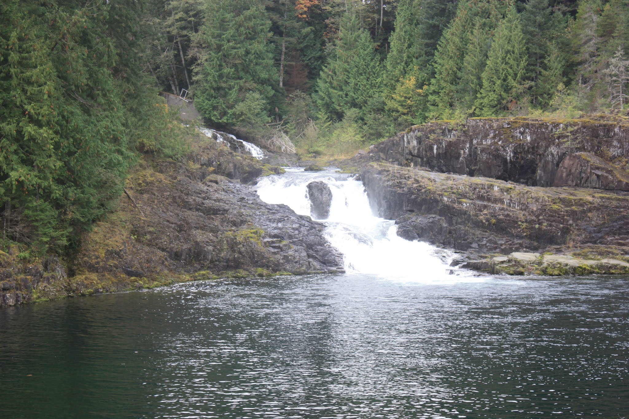
We did a short hike to various falls along the Campbell River on Vancouver Island in October, 2020 just before heading back to Calgary after a visit to Esther.

It is a beautiful, wide river, probably lots of fish. Esther watches the salmon run around Thanksgiving and swims with them. We started the hike along the shore to see 3 falls. The trail was developed by an electrical power plant at the beginning.

Herm thoroughly enjoys the size of these trees. Here a nurse log is part of the life cycle.
A long, metal suspension bridge goes over the gorge to give a good view of Elk Falls.

Elk Falls
Then we hiked down to the bottom of the gorge for another view.

The bridge from below.

Continuing along the trail, we came to gentle Deer Falls.

Then Moose Falls marked the end of the trail.


The big trees laying down in a dip were irresistible as a challenge to test my balance.

Big leaf maples!


Sunday, 15 November 2020

85. Paradise Meadows

Distance: about 15 km

Elevation: mostly level, some muddy climbing

On October 3, 2020, Herm and I took Evalyn and Heidi for a hike on Mt Washington on Vancouver Island. There were various route branches to take and we went about 15 km. It was enough, I was tired, the girls were amazing.

Much of the trail was on boardwalk because the meadows were so wet and the trail was so popular.
 

 Vegetation was so large and green and lush and beautiful; the bunch berries even tasted better.

Lakes along the way.

Chickadees, come and eat.


The meadows were full of low and high bush blueberries which the girls loved picking. They lovingly brought home a bowl of bunch and blue berries for poor mom who couldn`t hike. The red leaves were beautiful.

As we were crossing a bridge, we gratefully gave our tired feet a rest in the cold water. It felt so good. 

Home, sweet home for the tired ladies.


84. Rosewall Falls

 Distance: 5.8 km return

Elevation gain: some climbing up and down along the creek

On September 23, we went for a hike with Dave and Evalyn and Heidi on Vancouver Island. Unfortunately, Esther's sore feet wouldn't let her accompany us. It was a beautiful hike along a rushing creek/river with various falls and between rich greenery. 

Snack.

Group shot.

Beautiful, noisy spot and log for lunch. 

Rosewall Falls 

Trees fell across and they looked safe enough for me to follow Evalyn although she was much faster.

Dave caught a fish while we played, then tossed it back. A highly recommended hike.


Sunday, 28 June 2020

83. Mount Hoffman

Distance: 8.2 km
Elev. gain: 500 m

On Friday, June 26, we searched for a new hike before a forecast of week long rain and settled on Mount Hoffman in Sheep River country based on amazing good reviews.

The first beauty was the Sheep River with its cliffs and many falls which we had to cross to start.
We followed a gently rising fire road and then forest trail, admiring many flowers along the way, especially the trailing, purple clematis.
After a few short steep sections, we could see the clearing on top of the mountain.
One special flower was numerous Parry's townsendias.

Then the last leg up.
As promised, the views from the top were panoramic and beautiful.
We ate our lunch in the sunshine beside this attractive pinus contorta contorta.
Finally, we dutifully signed the register at the top. Not a very accurate record for Covid spread notification since we left no address but an indication of how very popular this trail was.
It was a good, moderate to easy hike so we considered adding another (Windy Point Ridge) but when we got there we decided to save it for another day.


Thursday, 5 September 2019

82. South Baldy

Distance: 11km return
Elevation gain: around 800m

Wednesday, September 4, a beautiful sunny day for a hike. South Baldy is close so we decided to go for it. Trail guides have various opinions about the difficulty but we could always turn back.
We started the hike around 10:00 on a beautiful trail.
Except for asters, the fall flowers were finished, so we enjoyed the various mushrooms.
We got to Baldy Pass, snacked and determined to try climbing the ridge in front of us.
It was a steep, rocky trail. After a few extra steep sections, we came to a crux, with no trail but lots of handholds. (not really scary)
The rocky steep humps continued.
From the top of this one we looked south to Midnight Peak which we had climbed some years before. It looked much higher but not as rocky.
To the west we saw Nakiska ski slope.
To the east, clear cuts in the foothills.
We got to the final hump before the final peak and decided we had gone far enough on this kind of trail. We admired the view for a while and went back down to the pass.
Behind us, are the south peak, the north peak sticking out to the right and the west peak to the left.
Coming up, I thought the return would be treacherous, but we chose our steps carefully without mishap.
 Red patches of Alpine Bearberry welcomed us back to the pass.